ArekmaneNador
Oriental, Morocco
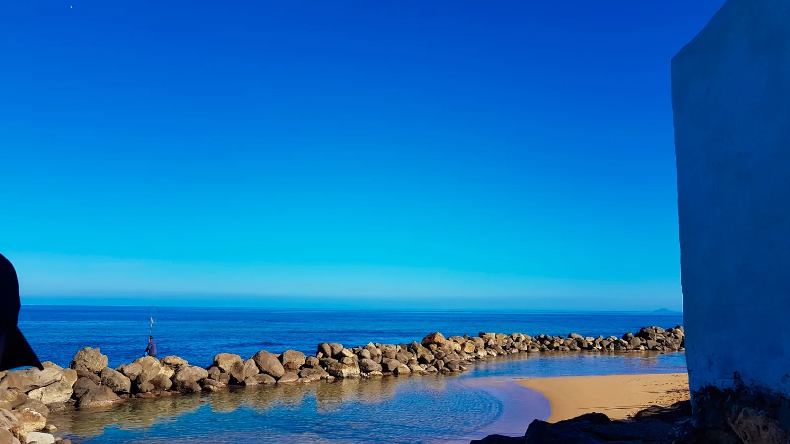
Arekmanenador is a sandy beach in the Oriental region of Morocco, near the town of Arkemán on the western-facing coast. This Blue Flag beach has been recognized since 2013 for its standards and facilities. The beach attracts many Moroccan tourists during summer months and serves…
Quick Overview
Plan Your Visit to ArekmaneNador
The key facts before you go
About the Beach
What is ArekmaneNador?
Arekmanenador is a sandy beach in the Oriental region of Morocco, near the town of Arkemán on the western-facing coast. This Blue Flag beach has been recognized since 2013 for its standards and facilities.
The beach attracts many Moroccan tourists during summer months and serves both as a swimming destination and a venue for leisure and environmental education programs. Water temperatures climb from mild in winter to warm by mid-summer, making the May to October period the main swimming season.
It sits alongside other certified beaches in Oriental, part of a broader network of other Blue Flag beaches in Morocco certified annually by the Foundation for Environmental Education.
Sunrise, Sunset & Beach Direction
ArekmaneNador faces west toward Alboran Sea. The best light for photography and swimming is typically in June, September. Direct sun hours follow that facing.
Planning
When to Go: Month by Month
| Month | Air Temp | Water Temp | Crowds |
|---|---|---|---|
| Jan | 12°C | 16°C | Low |
| Feb | 13°C | 15°C | Low |
| Mar | 15°C | 16°C | Low |
| Apr | 17°C | 17°C | Low |
| May | 20°C | 18°C | Low |
| Jun | 24°C | 21°C | Med |
| Jul | 27°C | 23°C | High |
| Aug | 27°C | 24°C | High |
| Sep | 24°C | 23°C | Med |
| Oct | 21°C | 21°C | Low |
| Nov | 16°C | 18°C | Low |
| Dec | 13°C | 17°C | Low |
When is the best time to visit ArekmaneNador?
The best time to visit ArekmaneNador is June, September. Air temperatures peak around 26.5°C in summer. Peak water temperature reaches 23°C in July.
How crowded does ArekmaneNador get?
How busy does Arekmanenador get? During summer months, the beach experiences significant footfall from Moroccan national tourists, particularly from June through August. This is when facilities are most actively staffed and seasonal programs operate at full capacity.
The described profile as 'visited by many national tourists during the summer season' indicates it's a recognized local destination rather than an undiscovered spot. Peak times fall during school holidays and weekends in July and August, when you'll encounter the most people. Early mornings and late afternoons typically offer quieter conditions.
May and September see moderate crowds, warm enough for swimming but outside peak summer holidays, so the beach remains reasonably accessible. October marks the tail end of the season; crowds thin noticeably as water temperatures drop and school terms resume. Winter months from November onward are far quieter, though cold water limits swimming to determined visitors.
Is ArekmaneNador open year-round?
The beach itself is accessible year-round, though staffed facilities including lifeguards typically operate only during the official season (15-06 – 15-09). The Blue Flag is displayed during the certification period only.
The Water
Swimming and Beach Life at ArekmaneNador
Is ArekmaneNador safe to swim?
ArekmaneNador is Blue Flag certified, which requires meeting strict bathing water standards set by the EU Bathing Water Directive.
What is the water temperature at ArekmaneNador?
Peak water temperature at ArekmaneNador reaches around 23°C in July, making it comfortable for swimming during the summer months. In winter (January), air temperatures average 12.3°C.
What is the beach like at ArekmaneNador?
What makes Arekmanenador distinct is its combination of sandy terrain and comprehensive facilities. The beach is well-equipped compared to many coastal options in the region, with lifeguards on duty during the season, a significant safety feature for swimmers. The orientation facing west provides afternoon sun exposure typical of this stretch of the Moroccan coast.
Water temperatures here reflect Mediterranean and Atlantic influences. Winter months bring cold water around 12.8–16.6°C, making swimming uncomfortable for most visitors. Spring sees gradual warming: March reaches 15.7°C, April climbs to 16.5°C, and by May you're at 18.2°C, marking the practical start of the swimming season.
Summer months are optimal: June averages 20.6°C, July 23.0°C, and August peaks at 24.4°C. Autumn remains warm through September (23.1°C) and October (20.9°C), but November drops sharply to 18.4°C. Air temperatures show less variation than water, with winter averaging 12.3°C and summer peaks of 27.3°C in August.
This means beach visits outside the official swim season are possible for walking, sunbathing, or simply enjoying the coast, though water entry requires a wetsuit from November through April. The beach hosts structured activities beyond simple swimming and sunbathing. During the season, leisure activities and environmental education programs run for various age groups.
These initiatives suggest the beach management takes community engagement seriously. The sandy composition is suitable for families with children, and the presence of lifeguards adds practical reassurance.
ArekmaneNador sits on the Alboran Sea: explore all Blue Flag beaches on the Mediterranean.
While You're Here
Beyond ArekmaneNador
Arkemán, the nearest city to Arekmanenador, serves as the local hub for services and supplies. The Oriental region of Morocco offers broader coastal exploration opportunities. The western-facing coastline in this area provides different atmospheric conditions than Mediterranean beaches further east.
Visitors based at Arekmanenador can use the beach as a home base for exploring local Moroccan culture, regional markets, and nearby villages. The presence of environmental education programs suggests local ecological sites or nature reserves worth investigating. Fishing communities and traditional coastal activities remain visible in settlements around Arkemán, offering insight into the region's maritime heritage.
Transport
Getting to ArekmaneNador
How do I get to ArekmaneNador by car?
ArekmaneNador is approximately 6.4 km from Arkemán. Follow local road signs to the beach. Check Google Maps or a local map for the most current directions.
What is the nearest airport to ArekmaneNador?
The nearest airport is Melilla Airport (MLN), approximately 27.2 km away.
Can I get to ArekmaneNador by public transport?
Public transport options vary by season. Check local transport authority websites for current bus and train schedules connecting to Arkemán. The nearest recorded bus stop is 155 m from the beach.
Is there a train to ArekmaneNador?
ArekmaneNador lists Selouane سلوان as the nearest railway station, 18.65 km away. Check current timetables before travelling.
Nearby
Near ArekmaneNador
Mapped toilets, bus stops, cafés, parking, and shops within about 500 m of ArekmaneNador. Distances are walking-line estimates from the beach pin.
Map loads when you ask. Tiles stay off the first paint.
Map: OpenStreetMap (ODbL)
Bus near ArekmaneNador
- L 8 Arkmane Centre Bus stop 155 m
- L 8 Oued Taleb Bus stop 252 m
- L 8 Oued Taleb Bus stop 278 m
Source: © OpenStreetMap contributors (ODbL). Names and positions come from mapped OSM features. Confirm on site.
On the beach
Facilities at ArekmaneNador
- Lifeguards
- Yes, during the certified season
- Wheelchair access
- Accessible site facilities and water entry
- Visual assistance
- No
- Toilets
- No
- Showers
- No
- Parking
- No parking listed nearby
- Entry
- Free to enter
These details can change. Check on arrival.
Practical Details
Practical Information
| At the Beach | |
| Official Season | 15 Jun – 15 Sep |
|---|---|
| Beach Type | Sandy beach |
| Nearest supermarket | 4.2 km from the beach |
| Nearest bus stop | 155 m from the beach |
| Visiting Information | |
| GPS Coordinates | 35.1057°N, 2.7464°W |
| Blue Flag Operator | Foundation for Environmental Education (FEE), Morocco |
Frequently Asked Questions
ArekmaneNador FAQ
Is Arekmanenador worth visiting?
Yes, if your travel dates align with the May–October swimming season. The Blue Flag status since 2013 indicates maintained facilities and lifeguard presence, important safety factors. The beach's sandy composition and structured seasonal activities make it suitable for families and groups.
It's not a hidden destination, it's a recognized local beach with practical amenities. Worth considering if you're traveling in the Oriental region and want a reliable, equipped beach rather than searching for lesser-known spots.
How do I get to Arekmanenador?
From there, rent a car or use bus/taxi services to reach Arkemán and the beach. The drive takes several hours depending on traffic and your exact starting point.
Once in Arkemán, the beach is the local focal point. No direct train or bus routes are widely documented for this specific location, so private or rental transport remains the most straightforward option from major hubs.
What's the best time of year to visit?
June through September offers the warmest water (22–24.4°C) and most active facilities. July and August are peak season with full amenities but higher crowds.
May and October are shoulder months: water is cool but swimmable (18.2°C and 20.9°C respectively), and beaches are quieter. Avoid November through April unless you enjoy cold-water swimming or prefer solitude; water temperatures drop to 12.8–18.4°C, making traditional swimming uncomfortable.
What facilities are there at Arekmanenador?
The beach is described as 'very well equipped' and maintains Blue Flag status, indicating lifeguards, maintained facilities, and safety standards. Seasonal leisure activities and environmental education programs run during the main season.
Specific details on restrooms, showers, food outlets, or rental services aren't documented, so contact local tourism information for current facility inventory. The presence of lifeguards is confirmed, a key safety feature.
Is Arekmanenador suitable for families?
Yes. The sandy beach terrain is accessible for children, lifeguards are on duty during the season, and structured seasonal programs suggest family-friendly activities. The blue flag certification reflects maintained safety standards.
Water temperatures from June through September are warm enough for comfortable swimming. The presence of organized activities indicates the beach caters to various age groups. Plan visits during May–October when facilities and programs operate and water temperatures reach comfortable levels.
Is there a bus near ArekmaneNador?
Yes. OpenStreetMap maps a public-transport stop 155 m from ArekmaneNador (L 8 Arkmane Centre), plus 2 more within about 500 m. Check current timetables before you travel. © OpenStreetMap contributors (ODbL).
Explore More
Nearby Blue Flag Beaches
Editorial
From the Zeach Blog
Everything you need to know about what makes a beach qualify for Blue Flag status, from water quality to environmental education.
Read moreOur editorial team's pick of the standout Blue Flag beaches in Morocco, rated for family friendliness, scenery, and facilities.
What the flag actually means, how certification works, and why a Blue Flag is a genuinely reliable signal, not just a marketing tool.
Read moreSources
Last verified September 2026. National operator pages and FEE listings are the primary certification sources.