Tavernes de la Valldigna
Valencian Community, Spain: Excellent water quality
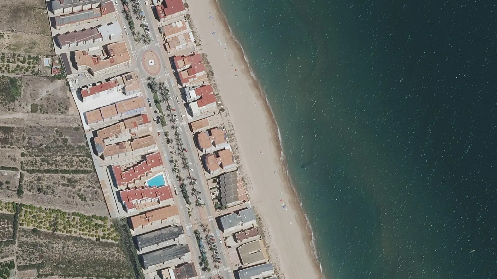
Tavernes de la Valldigna is an urban beach in the Valencian Community, located 5 km from the town of Tavernes de la Valldigna. The beach features fine sand and faces west, offering both swimming and water sports opportunities. With lifeguards stationed from June through September,…
Quick Overview
Plan Your Visit to Tavernes de la Valldigna
The key facts before you go
About the Beach
What is Tavernes de la Valldigna?
Tavernes de la Valldigna is an urban beach in the Valencian Community, located 5 km from the town of Tavernes de la Valldigna. The beach features fine sand and faces west, offering both swimming and water sports opportunities. With lifeguards stationed from June through September, plus nearby sports installations and rental facilities, this is a well-equipped coastal destination.
The beach sits in a distinctive horseshoe-shaped valley that opens to the sea, creating a unique landscape setting. Water quality is rated as excellent, making it a reliable choice for Mediterranean swimming on Spain's eastern coast.
It sits alongside Blue Flag beaches in Valencian Community, part of a broader network of Blue Flag certified beaches across Spain certified annually by the Foundation for Environmental Education.
Sunrise, Sunset & Beach Direction
Tavernes de la Valldigna faces west toward Balearic Sea. The best light for photography and swimming is typically in April, May, June. Direct sun hours follow that facing.
Planning
When to Go: Month by Month
| Month | Air Temp | Water Temp | Crowds |
|---|---|---|---|
| Jan | 11°C | 14°C | Low |
| Feb | 12°C | 14°C | Low |
| Mar | 13°C | 14°C | Low |
| Apr | 15°C | 16°C | Med |
| May | 19°C | 18°C | High |
| Jun | 23°C | 22°C | High |
| Jul | 26°C | 25°C | High |
| Aug | 26°C | 27°C | High |
| Sep | 23°C | 25°C | Med |
| Oct | 19°C | 22°C | Low |
| Nov | 15°C | 19°C | Low |
| Dec | 13°C | 16°C | Low |
When is the best time to visit Tavernes de la Valldigna?
The best time to visit Tavernes de la Valldigna is April, May, June. Air temperatures peak around 26°C in summer. Peak water temperature reaches 25.3°C in July.
How crowded does Tavernes de la Valldigna get?
Tavernes de la Valldigna operates as an urban beach with standard summer seasonality. Peak use occurs during July and August when water temperatures reach their warmest at 25.3°C. The lifeguard presence from 10:00 to 20:00 daily during this period indicates expected visitor concentrations during those hours.
As an urban beach with organized facilities, it attracts families and regular swimmers rather than those seeking isolation. The sports installations suggest younger, activity-focused visitors share the space. June sees lighter use despite swimmable water at 20°C, as most swimmers wait for warmer July conditions.
By September, crowds typically diminish as schools return and air temperatures drop to 25.3°C. Winter months from November through March see minimal beach use, with water temperatures ranging from 15.6°C. The horseshoe valley setting may provide natural crowd distribution compared to linear beaches.
Weekend patterns follow typical Mediterranean patterns, with higher Saturday-Sunday attendance. Weekday afternoons during summer months tend toward moderate crowds when lifeguards are present.
Is Tavernes de la Valldigna open year-round?
The beach itself is accessible year-round, though staffed facilities including lifeguards typically operate only during the official season (14-04 – 30-09). The Blue Flag is displayed during the certification period only.
The Water
Swimming and Beach Life at Tavernes de la Valldigna
Is Tavernes de la Valldigna safe to swim?
Tavernes de la Valldigna is Blue Flag certified, which requires meeting strict bathing water standards set by the EU Bathing Water Directive. The latest official class is Excellent (2025).
Water quality
Excellent (2025)
Earlier seasons: 2024 Excellent, 2023 Excellent, 2022 Excellent.
Excellent is the top class under the EU Bathing Water Directive. Recent samples stayed inside the strictest limits for bacteria.
Source: European Environment Agency
What is the water temperature at Tavernes de la Valldigna?
Peak water temperature at Tavernes de la Valldigna reaches around 25.3°C in July, making it comfortable for swimming during the summer months. In winter (January), air temperatures average 11°C.
What is the beach like at Tavernes de la Valldigna?
Tavernes de la Valldigna is a working urban beach with consistent fine sand and west-facing orientation. The swimming season runs from July through August, when water temperatures peak at 25.3°C. During the peak season, lifeguards work daily from 10:00 to 20:00, providing oversight across the entire lifesaving period from 1 June to 30 September.
The beach accommodates active visitors through dedicated sports installations available for rental. These facilities support various activities beyond basic swimming. The sand quality remains stable, and the urban setting means regular maintenance and accessibility features are standard.
Water quality consistently rates as excellent, reflecting proper bathing water management. June water temperatures reach 20°C, making early summer swimmable for those comfortable with cooler water. By September, temperatures drop to around 20°C again as autumn approaches.
The geographical setting distinguishes this beach from others in the region. The horseshoe valley formation creates natural wind protection and varied landscape views. This geological feature, combined with dune areas nearby, offers visual interest beyond the typical linear beach profile.
The beach location between Goleta's beaches and the dune area provides access to different coastal environments within short distances. Accommodation options exist directly near the beach, supporting extended visits. Handicap facilities are available, ensuring accessibility for visitors with mobility needs.
Public transport connections serve the beach, reducing car dependency. The combination of fine sand, excellent water quality, organized lifeguard coverage, and available amenities makes this a functional Mediterranean beach destination for swimmers and water sports enthusiasts.
Tavernes de la Valldigna sits on the Balearic Sea: explore all Blue Flag beaches on the Mediterranean.
While You're Here
Beyond Tavernes de la Valldigna
The horseshoe valley landscape surrounding Tavernes de la Valldigna offers varied natural exploration beyond the beach itself. The town's website (www.valldignaturisme.org) provides detailed information about local attractions and activities. The valley formation creates different landscape zones worth exploring on foot or by bike, from coastal dunes to inland valley slopes.
Nearby Goleta's beaches provide alternative swimming locations within accessible distance. The dune areas adjacent to the main beach preserve coastal ecology and offer different perspectives on Mediterranean geography. These natural sites support environmental education programs, with organized activities exploring local ecosystems.
The municipality of Tavernes de la Valldigna itself functions as a modest inland base, with local services supporting beach visitors. The CV-603 road connection from the A-7 motorway traverses landscape typical of this coastal region, passing through agricultural areas and settlement patterns characteristic of the Valencian Community. Local accommodation options encourage stays longer than single-day visits, allowing time to understand both beach and inland environments.
Transport
Getting to Tavernes de la Valldigna
How do I get to Tavernes de la Valldigna by car?
Tavernes de la Valldigna is approximately 4.96 km from Tavernes de la Valldigna. Follow local road signs to the beach. Check Google Maps or a local map for the most current directions.
What is the nearest airport to Tavernes de la Valldigna?
The nearest airport is Valencia Airport (VLC), approximately 49.7 km away.
Can I get to Tavernes de la Valldigna by public transport?
Public transport connections serve Tavernes de la Valldigna beach directly. Coach services operate from regional destinations, though specific schedules require checking with local transport authorities.
The urban location ensures bus routes reach the beach area, reducing car dependency for some visitors. Service frequency varies seasonally, with more options during summer months.
Map
Find Tavernes de la Valldigna
Open the map or get directions to the Tavernes de la Valldigna pin. Amenity names are listed here only when OpenStreetMap has a mapped feature nearby.
Map loads when you ask. Tiles stay off the first paint.
Map: OpenStreetMap (ODbL)
On the beach
Facilities at Tavernes de la Valldigna
- Lifeguards
- Yes, during the certified season
- Wheelchair access
- Accessible site facilities and water entry
- Visual assistance
- No
- Parking
- 157 m away, no parking fee
- Entry
- Free to enter
These details can change. Check on arrival.
Map data © OpenStreetMap contributors
Practical Details
Practical Information
| At the Beach | |
| Official Season | 14 Apr – 30 Sep |
|---|---|
| Beach Type | Sandy beach |
| Visiting Information | |
| GPS Coordinates | 39.0921°N, 0.2167°W |
| Water Quality | Excellent (2025) (EU Bathing Water Directive) |
| Blue Flag Operator | Foundation for Environmental Education (FEE), Spain |
Frequently Asked Questions
Tavernes de la Valldigna FAQ
Is Tavernes de la Valldigna worth visiting?
Yes, if you seek a functional Mediterranean beach with reliable facilities and excellent water quality. The fine sand, lifeguard coverage during summer, and sports installations support active beach time. The distinctive horseshoe valley setting provides landscape variety.
However, this is an urban beach suited to organized swimming rather than solitude. It works well for families needing amenities and for water sports enthusiasts using rental facilities. The worth depends on your priority, easy access, safety, and facilities rank high; crowds and development are trade-offs.
How do I get to Tavernes de la Valldigna?
By car, take the A-7 motorway to exit 59 or 60, then follow the local road CV-603 into town. The beach lies 5 km from the municipality center.
Public buses connect to the beach area directly, though schedules vary seasonally. For drivers, the motorway access is straightforward; the CV-603 local road is well-signposted.
What's the best time of year to visit?
July and August offer peak conditions with water temperatures at 25.3°C and air temperatures around 26°C. Lifeguards work daily 10:00-20:00 throughout June-September. June provides 20°C water with fewer crowds.
September remains warm at 25.3°C air temperature but water cools to 20°C. Winter swimming is possible but cold, water drops to 8-10°C. Most visitors come July-August; shoulder months (June, September) reduce crowds while maintaining good swimming conditions.
What facilities are available at Tavernes de la Valldigna?
The beach offers lifeguards (June-September, 10:00-20:00), sports installations for rental, public transport access, and handicap facilities. Accommodation exists directly near the beach. Car rental services are available.
Public amenities support urban beach standards. Environmental education programs explore nearby natural sites.
The nearby municipality provides food and service options. However, specific facilities like showers, toilets, or beach bars require verification through the local tourism website (www.valldignaturisme.org).
Is Tavernes de la Valldigna suitable for families?
Yes. Lifeguard presence from June-September, excellent water quality, fine sand, and handicap facilities support family use. Sports installations offer activities for different ages.
Nearby accommodation and local services reduce planning complexity. The urban setting ensures safety and accessibility.
Water temperatures suit children in July-August (25.3°C). However, confirm specific family facilities like changing areas or children's programs through local tourism information, as these aren't detailed in official data.
Editorial
From the Zeach Blog
Everything you need to know about what makes a beach qualify for Blue Flag status, from water quality to environmental education.
Read moreOur editorial team's pick of the standout Blue Flag beaches in Spain, rated for family friendliness, scenery, and facilities.
What the flag actually means, how certification works, and why a Blue Flag is a genuinely reliable signal, not just a marketing tool.
Read moreSources
- Foundation for Environmental Education: Blue Flag programme
- FEE site listing for Tavernes de la Valldigna
- ADEAC (Asociación de Educación Ambiental y del Consumidor)
Last verified September 2026. National operator pages and FEE listings are the primary certification sources.